1000 controls – one session
Sunday the 29.03.2020 Eirik Kamstrup Hovind and I went out for quite an extreme control-picking session. 1000 controls in one session.
We had a few rules for the session: We were running on maps after ISOM standard and we were not placing any controls on trail junctions. There were no flags out in the forrest, but we had to touch (either with our foot or hand) every object and say something so that the „punching“ of the control gets confirmed. Eirik usually went for „ja“ („yes“), and I punched the control by saying „her“ („here“) or „jepp“.
It turned out to be a quite exhausting session (both for the mind and body), but actually not as exhausting as we thought beforehand. Most of the time it was great fun actually.
We ended up running on maps in 1:2500 scale in order to ensure good readability. A big scale means also many maps. So in total both of us had 15 maps (A4) to carry around the course. In the end we were running more then 25 km and 4 hours through the terrain of Nordmarka.
Have a look on our map and gps-track!
One leg wonder
One week later we were going out for a new long session. This time it was ment to be extreme into another direction. Inspired by Martin Regborns long leg from November 2017 we wanted to find a place to beat that unoffical record.
We followd mostly the same standards as Martin Regborn did. That means:
1. Only one leg in a straight line.
2. The whole leg must be on orienteering maps (ISOM) (No pure laserscanning data, hiking maps or similar).
3. Staying in a 200m broad corridor (100m to each side from the straight line).
4. Following the IOF competition-rules.
In order to follow these rules the preparation of this session took quite some time. Finding an area of more than 30 km with orienteering maps (ISOM) is the first big challange. It might have been possible in Normarka (direction east<->west), but some places still had too much snow. So we ended up preparing the leg in Østmarka from north to south. After getting all the maps we needed we had to find a spot where a straight line in a 200m broad corridor looks realistic to execute (e.g. no big lakes or cliffs in the corridor).
In the end we found a 33km straight leg that fulfilled the conditions. In scale 1:10000 the leg was crossing over 12 maps (A4). You can find the whole leg with our GPS-track in loggator.
Luckily we got Håvard Haga to join our project as a supporter throughout the race. Next to the start and finish Håvard met us on 3 different places through the course in order to provide us with some food and dry clothes.
We started our project on sunday the 05.04.2020 at 10:00. Somehow our project got far more attention than we expected. Probably many sport-enthusiasts (mostly orienteerers i guess) were eager to follow at least some sport on television at these days. Burgunder-TV was sending a commented live broadcast of the whole project with gps-tracking, live pictures from the forrest and interviews. The GPS-tracking through loggator was followed by 2500 users from 43 different countries.
Since many people were following the live gps, some of them were also going out and cheering for us in the forrest. That was of course really fun, but all the attention we got also caused us some trouble. More about that later.

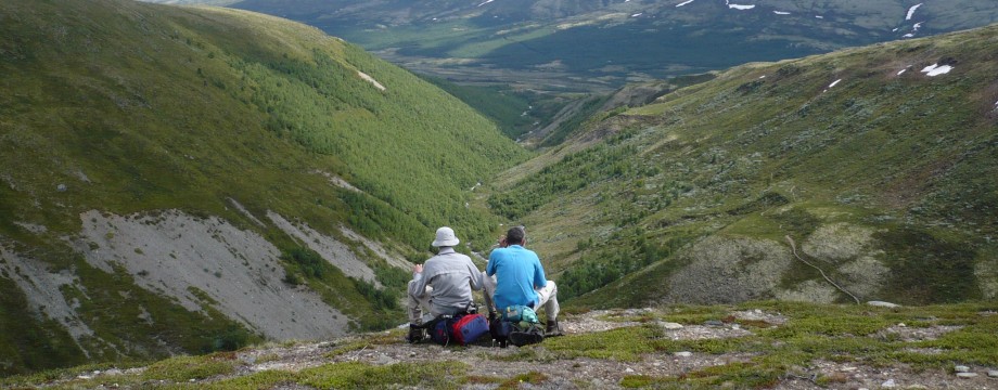
All the way until our first short break was great fun. It was a bit cold, foggy and some rain, but Østmarka is still such a nice place to run orienteering. The forrest has quite many steep hills and cliffs, but with all the small lakes and open forrest on the hill tops it is very fun to run orienteering there (or trail running, mountainbiking or hiking). After 6 km we saw a moose on one of the nice open hilltops just infront of us. At the end of Langvann Håvard was waiting for us and after a short stop and a half banana we continued our trip.

The next 7 km until we would meet Håvard again were exciting. We knew that at the end of this stage we would have to cross a small lake that covered the 200m of our corridor. At this time of the year some of these lakes are still frozen and some are not. We had no idea what this lake would look like, but we knew Håvard was standing on the other side with a rope (in case we could go through the ice) and some dry running cloths. As we got closer to the lake we started to get a bit nervous, but when we saw it we were getting optimistic. There was no ice anymore and most of the lake was more like a big marsh so we just had to swim a few meters and then get through the marsh. Next to Håvard there was a small family waiting on the other side of the lake and cheering for us.

We took a break and changed into dry clothes. The 25 min break we took here was a bit longer than planned. The reason for that was that Håvards car got stuck in some mud and we tried to help him out. In the end we were so lucky that the family cheering for us had a tractor close by and could help us out.
The terrain for the second half of our leg was quite different. There were still some nice open hilltops, but the areas between these tops were often much more green (more dense forrest). We felt still good and continued in a nice flow. On some road crossing we met again some people cheering for us, and a bit later we saw once more a group of 3 moose on a clearing just infront of us.
After 24 km we had planned our last break for the session at the golf course at Smerta. Family Jonsson and Håvard met us there and we were again interviewed in the live broadcast of Burgunder-TV.
Unfortunately some issue came up during this interview. After 29,5 km we were planning to cross a railway. There was no official crossing point at that place where our corridor was, but as we had seen from sattelite pictures on google maps the railway was small and looked easy to cross. Anyway, someone watching the broadcast and seeing that we were about to cross the railway was working at the norwegian railway company. They told us that if they would see our GPS crossing the railway they would send a complain and we would most likely get a 10000 NOK fine. After checking some maps we found a railcrossing just about 1 km away from our corridor. So we decided to leave the corridor when we get there in order to cross the railway without getting a fine.
After crossing the golf field (we had to wait for some golfers to make their shot wich was just inside our corridor) we got into the forrest again.

6 km before the finish Eirik felt suddenly bad in his stomach and had to stop to throw up. After the stop he felt totally fine again and we continued in a good flow.
As we got closer to the railwaycrossing at 29,5 km we were surprised to see Håvard again. Apparently Håvard was in contact with the norwegian railway company. The guy he was talking to was very positive about our project and was actually working on stopping the train for a few minutes so that we could cross legally (and without getting a fine). Anyway we didn’t want to wait so long and decided to run to the official crossingpoint outside of the corridor. On the way we found a watertunnel that was going underneith the railway and was just on the edge of our corridor. After Håvard was calling the norwegian railway company again and the live broadcast on Burgunder-TV we finally got the message that it was okay to cross there.

Now it was just about finishing the whole project. We had only 3,5 km left, but could also feel that we were getting tired. Esspecially Eirik felt that he lost some energy through the vomiting. The terrain was getting fysically tough and technical demanding. For the last 3,5 km we only had a very old map from 1988 and we struggled in some parts to match the map with the terrain. 1 km before the finish we almost lost control and went outside the corridor.

After 37 km of running through the terrain (33 km straight line) and 1200m climb we arrived after a bit more than 5 hours (4,5 h effective running) at the finish. Exhausted but happy.

Thanks to Eirik for great company on both the 1000 controls session and our One leg wonder! Thanks to Håvard for the perfect service on this session. And thanks to the people cheering for us in the forrest and from home.
If you are interested in the course have a look at the gps-tracking here at loggator.
Next to some articles from the norwegian orienteering federation before and after this project and a report in the sports magazine Kondis we also made into the national evening news on NRK. You can watch it on nrk.no. (Dagsrevyen 21 from monday the 06.04.2020). The report starts after 18:40 min just before the weather forecast.
Or for not scandinavians you can watch the report through these two clips on instagram (not so good quality in the beginning):
It will be fun to follow the next runners doing more than 1000 controls in one session or running further than 33 km on a straight line on orienteering maps 🙂
